Naslax Geoservices provides mineral exploration and resource estimation support for mining, quarrying, and mineral development projects. We help clients evaluate geological conditions, identify exploration targets, mine planning, coal and non coal exploration, organize field data, and assess mineral potential for informed project planning. Major stages of mineral exploration
1. Mineral Exploration
Mineral exploration is the systematic process of identifying and investigating areas that may contain economically valuable minerals.
Major stages of mineral exploration
- Regional geological studies – Understanding regional geology, tectonics and mineralization.
- Remote sensing and GIS – Identifying geological structures and alteration zones using satellite imagery.
- Geophysical surveys – Detecting subsurface mineralization using magnetic, gravity, electrical and electromagnetic methods.
- Geochemical surveys – Collecting and analysing soil, rock, stream sediment and water samples.
- Geological mapping – Identifying lithology, faults, folds, fractures and mineralized zones.
- Exploratory drilling – Obtaining subsurface samples through diamond core or reverse circulation drilling.
- Laboratory analysis – Determining mineral grades and chemical composition.
2. Mineral Resource Estimation
Mineral resource estimation involves calculating the quantity, grade and spatial distribution of mineral deposits using geological, drilling and sampling data.
Main steps
- Geological database preparation
- Geological interpretation and 3D modelling
- Sample compositing
- Statistical and geostatistical analysis
- Variogram modelling
- Block model construction
- Grade interpolation
- Resource classification
- Validation and reporting
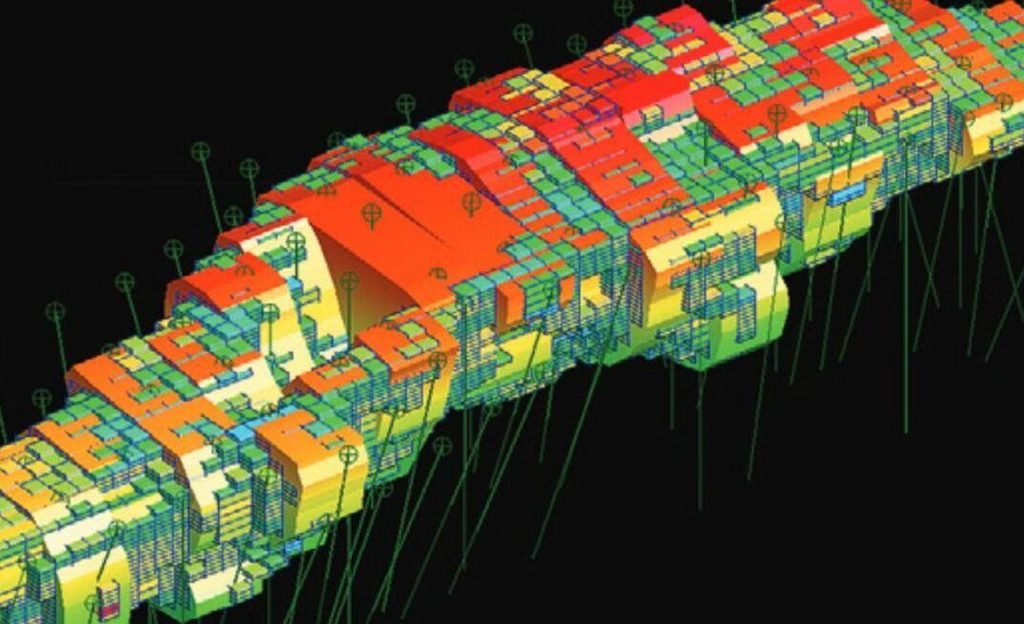
Geological modelling and mine planning software Surpac
3. Important Resource Estimation Methods
| Method | Application |
|---|---|
| Polygonal method | Simple geometric estimation |
| Triangular method | Estimation using triangular areas |
| Inverse Distance Weighting (IDW) | Distance-based grade estimation |
| Ordinary Kriging | Geostatistical grade estimation |
| Nearest Neighbour | Assigning nearest sample values |
| Multiple Indicator Kriging | Modelling complex grade distributions |
Our services include
- Preliminary geological assessment
- Geological mapping and field investigation
- Mineral exploration planning
- Surface sampling and data collection
- Exploration target identification
- Geological data compilation and interpretation
- Mineral resource estimation support
- Mining project evaluation
- Technical documentation and reporting
By combining geological understanding, field investigation, and technical analysis, we help clients improve exploration decisions to make mine planning and evaluate the development potential of mineral resources.